Did you know that Dronning Maud Land was completely unexplored until just 80 years ago?Dronning Maud Land is the Norwegian claim sector in Antarctica, annexed 14 January 1939. The area occupies one-sixth of the Antarctic continent and is almost seven times larger than Norway. It is named after Queen Maud of Norway (1869–1938).
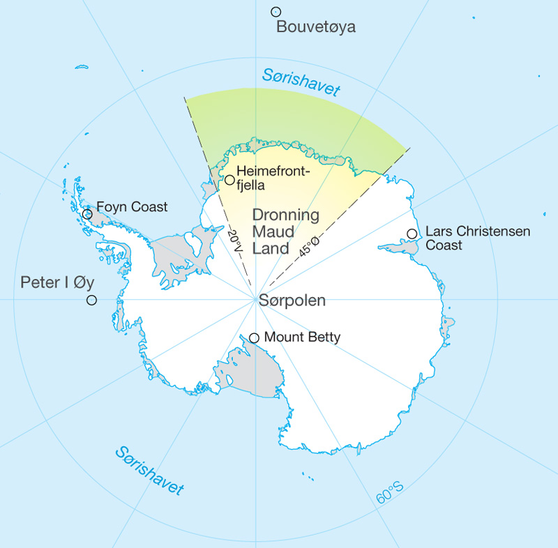
Fabian von Bellingshausen is usually credited with the discovery of Antarctica, but over a hundred years went by between von Bellingshausen’s visit and the exploration of Dronning Maud Land. When von Bellingshausen logged the position of his sailing vessel Vostok in January of 1820, he was 30 km off the coast of Dronning Maud Land. The expedition was financed by the Russian czar Alexander I in hope of finding thesouthern continent that everyone assumed must exist. In 1819, two ships set sail from St. Petersburg: the corvette Vostok and a support vessel with a total crew of nearly two hundred men. We do not know for certain whether von Bellingshausen saw the coast of Dronning Maud Land, or only the ice in the adjacent seas. The weather was poor, and the ships were forced to retreat out of the ice. It was Norwegian whaling activity in the region that prompted Norwegian interest in charting and later claiming the area. In 1989, when Norway claimed the sector between 20°W and 45°E, Stortinget did not delimit the northern and southern extent of the claim. The phrase used was: “...with the land lying inland of this shore and the seas lying there within, be laid under Norwegian sovereignty.” Dronning Maud Land borders on the British sector to the west and the Australian sector to the east. The seaward side of Dronning Maud Land contains ice shelves that float on the sea surface. In most cases the ice edge towers to a height of 20–30 metres. Between one and two hundred km from the coast the ice is nearly 2000 metres thick. A mountain chain sticks up out of this ice: jagged peaks and nunataks. The highest peak in Dronning Maud Land is Jøkulkyrkja, 3148 metres above sea level. But this is not the highest point in the Norwegian sector. In the eastern part of Dronning Maud Land, in the great South Polar Plateau that Roald Amundsen called Kong Haakon VII Vidde, there is an ice dome that soars to 3810 metres above sea level. This dome, called Valkyrjedomen, is the second highest summit on the Antarctic ice sheet – and one of the coldest places on Earth. |
South Pole 1911–2011 is an informational outreach project run by the Norwegian Polar Institute
Contact person: