Did you know that whaling sped up the mapping of Antarctica?
When whaling in the Southern Ocean began, in the early 1900s, the need for maps of relevant sea areas and coastlines became pressing.
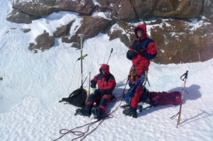
 Field work in the vicinity of the Norwegian research station Troll. Photo: Gudmund Melland and Yngve Melvær / Norwegian Polar Institute
The four Norwegian expeditions to Antarctica that were undertaken between 1927 and 1931 are called the Norvegia expeditions. Their aim was to assess the whale populations in the Southern Ocean, but they also did research and charted unknown regions. On the fourth and last Norvegia expedition, aircraft were used for the first time for reconnaissance and surveying on a broad scale.
The first expedition dedicated exclusively to surveying was carried out in 1936. This expedition implemented a new technique called photogrammetry, in which cartographic data are constructed from aerial photographs. The images were taken from the aircraft towards the ground at an angle, rather than straight down as is commonly done today. The swaths of photos overlapped by 60 % along each flight path, so the images could be viewed three dimensionally in a stereoscope. This made it possible to recreate the terrain and construct contour lines. The chief task for the expedition was to map the area between 20°W and 45°E longitude, that is, the area called Dronning Maud Land, which Norway annexed two years later. The surveying activities that Norwegian expeditions carried out during this period helped ensure the acceptance of Norway’s claim to Dronning Maud Land.
After the Second World War, Norway has mounted several mapping expeditions to Antarctica; the main goals have been to carry out aerial photography and geodetic measurements (surveying) for the creation of the Norwegian Polar Institute’s series of topographic maps of Dronning Maud Land in scale 1:250 000. The Polar Institute’s naming committee is in charge of establishing place names and maintaining a place name database for Norwegian polar areas, including Dronning Maud Land, Bouvetøya and Peter I Øy. In recent years, most of the Institute’s mapping activity in Antarctica has focused on detailed charting of the areas around the Norwegian research station Troll.