Did you know that there are rivers of ice?Ice streams, as these rivers are called, transport ice from the inner regions of Antarctica to the coast, where they calve as icebergs or melt under ice shelves.
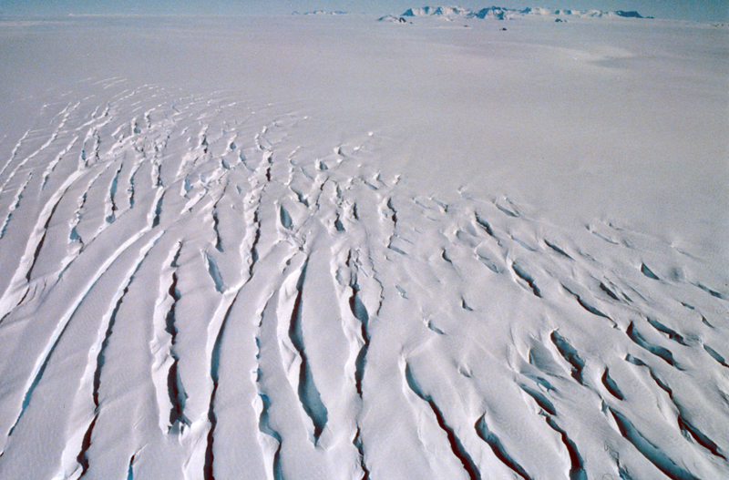
An ice stream can be compared to a river because its velocity is much higher than that of its surroundings. Ice streams are responsible for most of the drainage of mass from the Antarctic ice cap, because melting in coastal regions is negligible. An ice stream can be as much as 50 km wide, 2 km deep and its length can span hundreds of kilometres. Jutulstraumen is the most important ice stream transporting ice from Dronning Maud Land to the ocean. It drains an area of 124 000 square kilometres, corresponding to approximately 1/3 of the total area of Norway. The ice in Jutulstraumen flows at a rate of about 1 kilometre per year. Glaciologists need information about ice speed to help them understand the characteristics of the flowing ice, and to calculate how much ice is being lost from the inner regions of the Antarctic continent. Ice speed is measured by drilling holes in the ice and placing out aluminium stakes. The stake is fitted with a GPS receiver and its geographical coordinates are determined with the aid of satellites. If the stake’s position is measured again after a specific period of time, it is possible to calculate how far it has moved during that time, and thus also the speed with which the ice has moved. The fastest known ice stream is in Greenland (Sermeq Kujalleqs); it moves about 14 kilometres per year, most rapidly in the summer when it can advance 40 metres per day. |
South Pole 1911–2011 is an informational outreach project run by the Norwegian Polar Institute
Contact person: